A working index of ad hoc geospatial analyses for WFRC. Each analysis lives in its own folder under projects/, with its own data sources, script/notebook, and outputs. See README.md and CLAUDE.md at the repo root for conventions.
To start a new analysis, copy projects/_template/ (its underscore prefix keeps it – and any other in-progress scaffold folder – out of this published site by convention).
Center Buildout Capacity
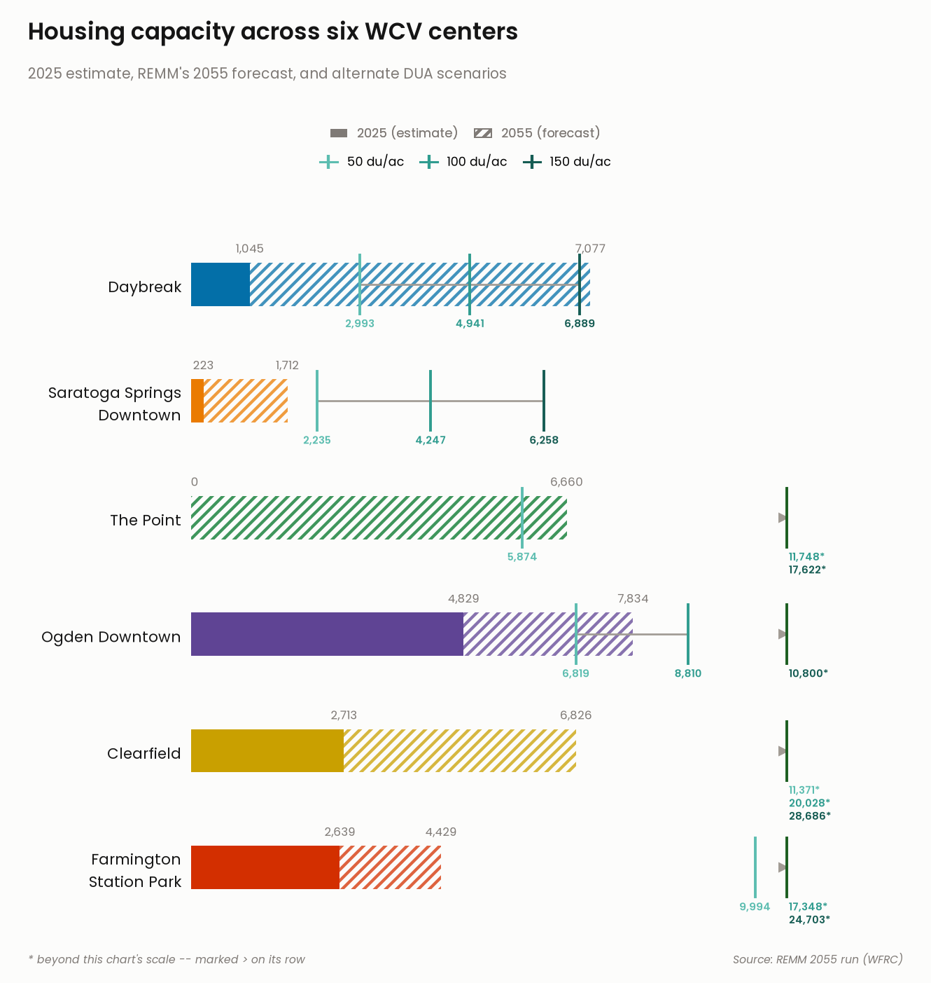
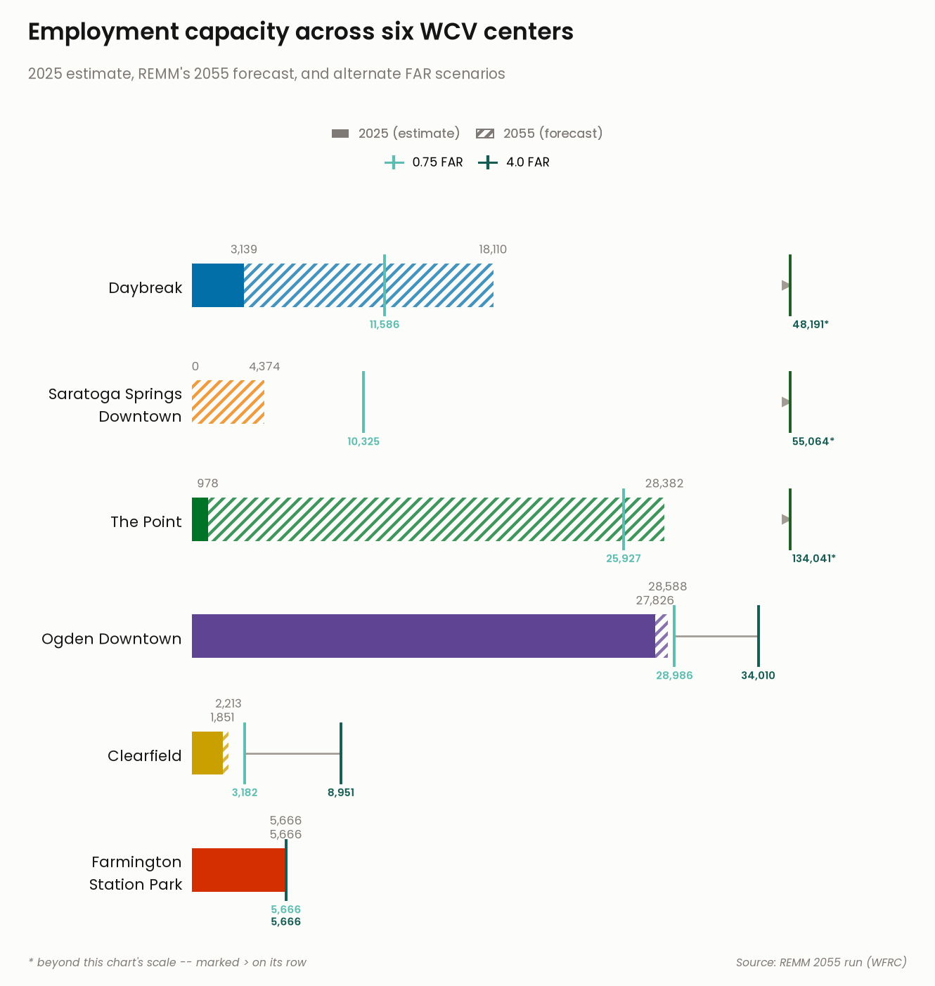
REMM’s 2025 estimate, its 2055 forecast, and full buildout capacity for six Wasatch Choice Vision centers: Daybreak, Saratoga Springs Downtown, The Point, Ogden Downtown, Clearfield, and Farmington Station Park.
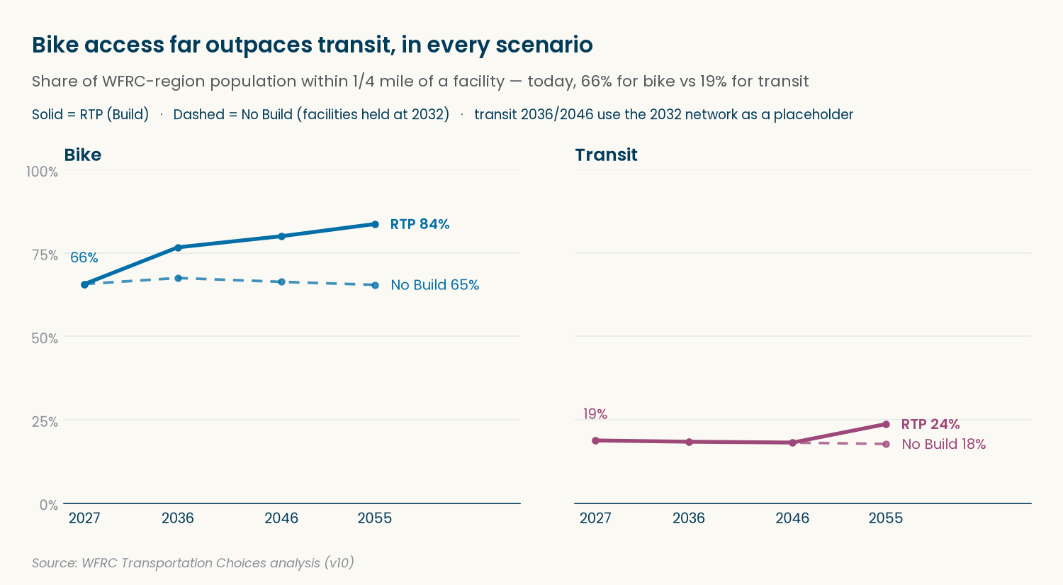
Transportation Choices
Percent of the WFRC-region population within 1/4 mile of a dedicated bike facility, or a frequent bus route / transit stop / station, across seven scenarios: Existing 2027, plus No Build and RTP (Build) in each of 2036, 2046, and 2055.