SE 2025 Urban Form D Variables
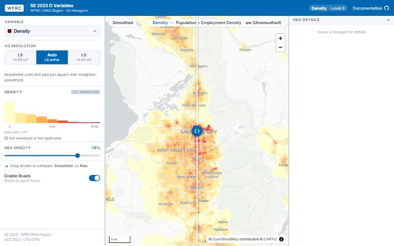
How does the built environment vary across the region, measured with the standard “D variables” of urban form?
What it answers
How does the built environment vary across the region, measured with the standard “D variables” of urban form?
For: Planners and analysts relating urban form to travel behavior.
What is inside
- {‘Six D variables’: ‘density, diversity, design, destinations, demographics and distance to transit, plus an income diversity index.’}
- A supplementary Rental Housing Attainability Index developed by Cascadia Partners with WFRC and UTA.
- Each measure at two hexagon sizes (H3 levels 8 and 9), smoothed and raw.
Where the data comes from
- WFRC’s SE 2025 socioeconomic data for the WFRC and MAG region.
About this tool
| Type | Analysis |
| Status | Live |
| Last updated | September 22, 2026 (latest change to the source code) |
| Terms | WFRC’s material is licensed CC BY 4.0; data from other sources keeps its own terms. See the terms of use. |
How to cite
Wasatch Front Regional Council. (2026). SE 2025 Urban Form D Variables [Online tool]. https://wfrcanalytics.github.io/GIS_SE2025_H3/
Questions or problems?
Email analytics@wfrc.utah.gov or open an issue on the source repository. See also all apps and maps.