Housing ATO Calculator
How well does each part of the Wasatch Front score on access to jobs, transit and everyday necessities, and what changes when I weight them differently?
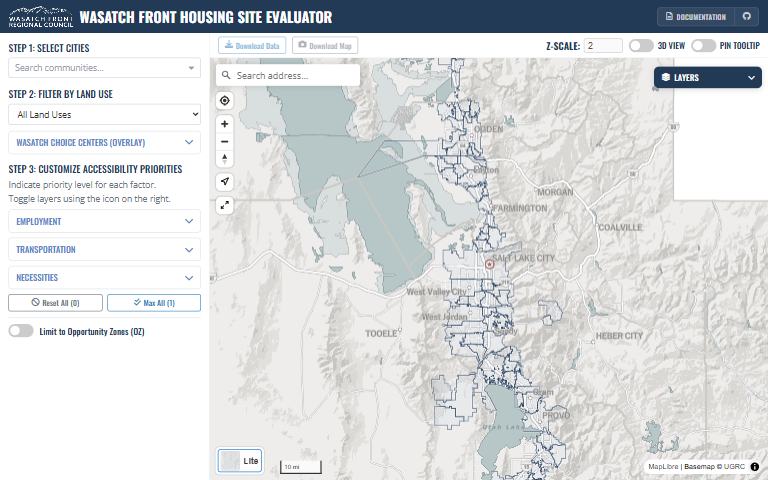
What it answers
How well does each part of the Wasatch Front score on access to jobs, transit and everyday necessities, and what changes when I weight them differently?
For: Housing and land-use planners, as a conversation starter and data-informed guide.
What is inside
- {‘Eleven access factors in three groups’: ‘employment, transportation and necessities.’}
- You choose which factors matter to your community and weight them; the map re-scores every parcel and hexagon.
- Reference layers for Wasatch Choice Centers and Opportunity Zones, which are shown but not scored.
Where the data comes from
- Jobs reachable by car and by transit from the WFRC Access to Opportunities data.
- Proximity to transit stops, freeway exits, bike lanes and trails, childcare, healthcare, education, grocery stores, community centers and parks.
About this tool
| Type | Map |
| Status | Live |
| Last updated | September 23, 2026 (latest change to the source code) |
| Terms | WFRC’s material is licensed CC BY 4.0; data from other sources keeps its own terms. See the terms of use. |
How to cite
Wasatch Front Regional Council. (2026). Housing ATO Calculator [Online tool]. https://wfrc.utah.gov/housing-ato-calculator-map/
Questions or problems?
Email analytics@wfrc.utah.gov or open an issue on the source repository. See also all apps and maps.